In this article
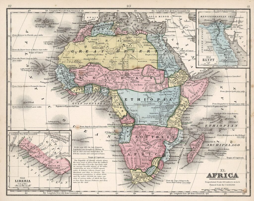
Look at a political map of Africa or the Middle East and you will see frontiers that run dead straight for hundreds of kilometers. Rivers and mountains rarely form straight lines. Officials in distant capitals did.
This article explains how many of today’s borders were drawn, why they still matter, and why governments have chosen to keep them even when they cause trouble.
Key facts
- 44% of Africa’s borders follow lines of latitude or longitude, according to African Union documents.
- Under a quarter of African borders were physically marked on the ground when the AU Border Programme began in 2007.
- 177 ethnic and cultural groups are split by African borders, according to a 2012 AU assessment.
- 1964: the year African leaders agreed to keep the borders they inherited at independence.
Lines on a map
Most modern borders in Africa and the Middle East were fixed between the 1880s and the 1920s. European governments negotiated them with each other, often before their officials had visited the land in question.
The best-known example is the Berlin Conference of 1884 to 1885, where European powers set rules for claiming African territory. The conference did not carve up the continent line by line, but it started a rush of treaties that did so over the following decades. Convenient markers such as rivers, watersheds and lines of latitude were used because they were easy to describe on paper.
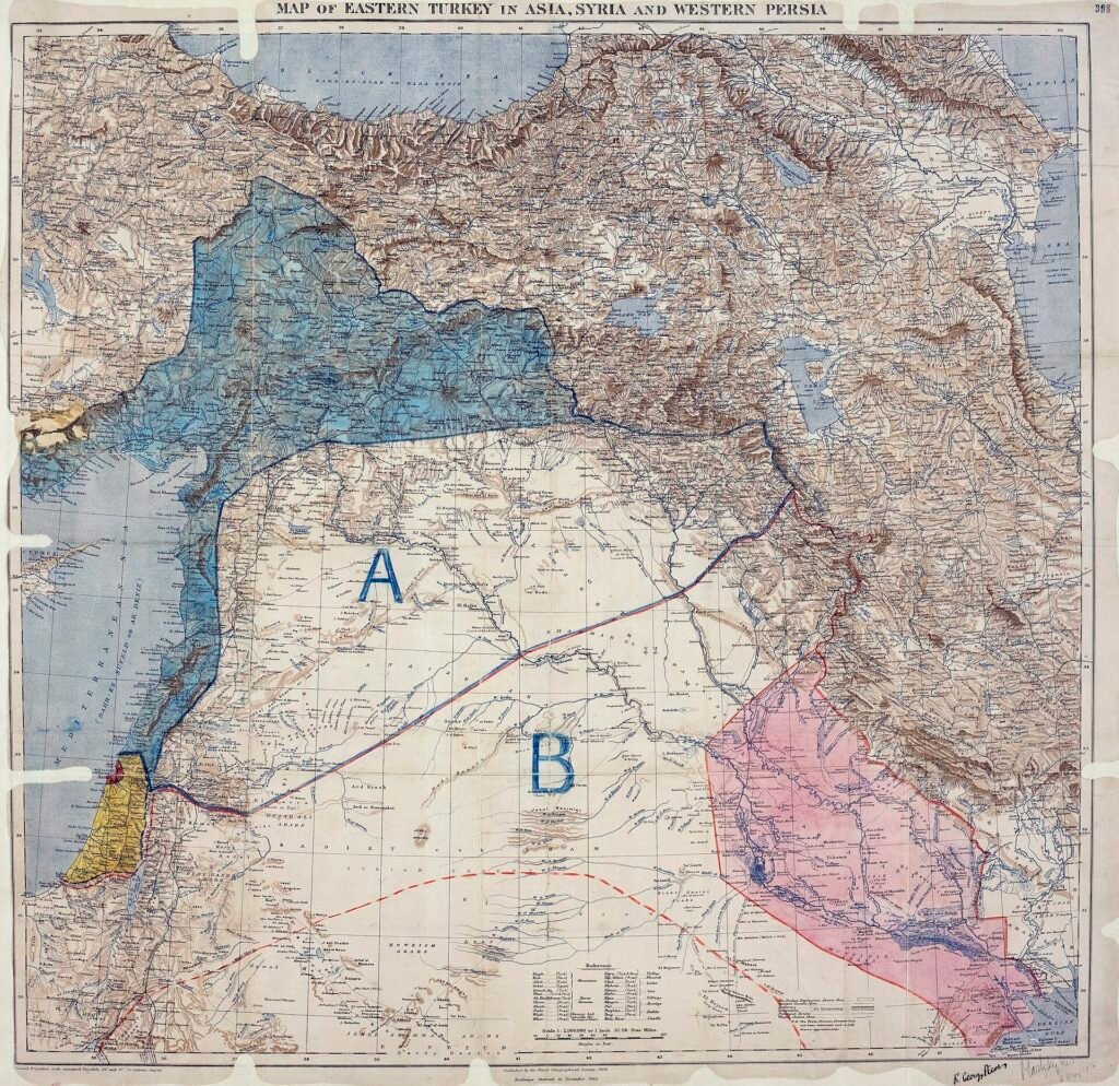
In the Middle East, the 1916 Sykes-Picot agreement between Britain and France divided the Ottoman Empire’s Arab provinces into zones of influence. The final borders of states such as Iraq, Syria and Jordan were set later, after the First World War, but the idea of lines drawn by outside powers became a lasting grievance in the region.
Why the choices still matter
A border decides which government collects taxes, whose laws apply and who can move freely. When it cuts across communities, the effects are felt for generations.
- Divided peoples: an assessment for the African Union in 2012 found that African borders split 177 cultural and ethnic groups. Families and trading partners can end up in different countries.
- Herders and seasonal routes: pastoral communities whose animals have crossed the same land for centuries now meet passports and customs posts.
- Shared resources: rivers, oil fields and fertile land that straddle a frontier become sources of dispute.
- Unmarked lines: when a border exists on paper but not on the ground, neither side knows exactly where it runs. That uncertainty has triggered clashes.
Why borders rarely change
At independence, many new African states faced a choice: reopen colonial borders or keep them. In 1964 the Organisation of African Unity, now the African Union, decided that members would respect the borders they had inherited. International law follows a similar principle, known as uti possidetis, which turns former colonial boundaries into international frontiers.
The reasoning was practical. If one border could be redrawn, dozens of others might follow, and each claim could lead to war. Stability was judged more important than fairness. The result is a paradox: lines that were arbitrary at birth are now defended fiercely by the states that inherited them.
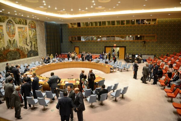
Decisions taken by powerful states in that era also shaped the institutions that still manage conflict, including the UN Security Council, whose permanent members were the victors of 1945.
How the UN Security Council Actually Makes Decisions
How disputes get settled
There is no quick fix, but several tools have worked:
| Method | How it works | Example |
|---|---|---|
| International courts | Both countries agree to accept a ruling from the International Court of Justice. | Cameroon and Nigeria over the Bakassi peninsula (ruling 2002, handover completed 2008) |
| Boundary commissions | Neutral experts study treaties and maps, then mark the line on the ground. | Eritrea-Ethiopia Boundary Commission (decision 2002) |
| Joint development | Neighbors share resources in a disputed zone instead of fixing one line. | Nigeria and Sao Tome and Principe Joint Development Zone for offshore oil |
| Demarcation programs | Governments survey and mark borders before disputes start. | African Union Border Programme, launched 2007 |
The African Union Border Programme set out to mark all remaining African borders by 2017, a deadline later extended to 2022. Progress has been slow: only about a third of Africa’s roughly 83,000 kilometers of land borders are properly demarcated, according to the Institute for Security Studies. Surveying remote land is expensive, and marking a line on the ground can itself reopen old arguments.
The same problem at sea
Maritime borders raise similar questions, often with higher stakes because of oil, gas and fishing rights. Narrow sea passages where borders and shipping lanes meet, such as the Strait of Hormuz, are covered in our guide to the world’s shipping chokepoints.
The bottom line
Borders drawn more than a century ago were rarely designed with local people in mind, yet most have survived because changing them looked even riskier. When you read about a border dispute, it helps to ask three questions: who drew the line, whether it was ever marked on the ground, and what resources lie along it.
Frequently asked questions
Did the Berlin Conference divide Africa?
Not directly. The 1884 to 1885 conference set rules for how European powers could claim African territory. The actual borders were drawn over the following decades through dozens of separate treaties between colonial governments.
Why are so many African borders straight lines?
Straight lines along latitude or longitude were easy to describe in treaties when negotiators had little detailed knowledge of the land. African Union documents estimate that 44 percent of the continent’s boundaries follow such lines.
Can a border ever be changed peacefully?
Yes. Countries can agree to adjust a border by treaty, accept a ruling from the International Court of Justice, or follow the decision of a boundary commission. The handover of the Bakassi peninsula from Nigeria to Cameroon, completed in 2008 after a court ruling, is one example.
Sources
- Institute for Security Studies (ENACT): Ten years of the AU Border Programme
- African Union: Delimitation and demarcation of boundaries in Africa (2013)
- African Union: Declaration on the AU Border Programme
- International Court of Justice: Land and Maritime Boundary between Cameroon and Nigeria
- The National Archives (UK): Sykes-Picot agreement map, 1916